🚤 Navigate the Waves with Confidence!
The Garmin GPSMAP 86Sci is a floating handheld GPS designed for marine enthusiasts, featuring a sunlight-visible 3” display, preloaded BlueChart G3 coastal charts, and robust inReach satellite communication capabilities. With its water-resistant design and button operation, it ensures ease of use on the water while providing essential navigation and safety features.
| Display Type | Color TFT |
| Human-Interface Input | Buttons |
| Control Method | Remote |
| Are Batteries Included | Yes |
| Connectivity Protocol | Bluetooth |
| Sport Type | Fishing |
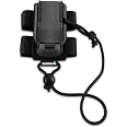
| Mount Type | Wrist Mount, found in image |
| Resolution | 246 x 322 |
| Compatible with Vehicle Type | Boat |
| Screen Size | 3 Inches |
| Additional Features | Bluetooth |
| Connectivity Technology | Bluetooth |
| Map Types | Nautical |
| Item Weight | 1.5 Pounds |
| Item Dimensions L x W x H | 1.7"L x 2.8"W x 7"H |
J**R
Good value and quality product
This works great and is a good affordable solution for our day sailor. The battery lasts quite a long time too. The charts are very accurate to keep out of the shallows and away from hazards.
J**L
Great tool
I bought this after getting lost in the mangroves for several hours while out paddling. My phone went dead and at dusk my husband called 911. I found my way off the water and looked up and there was a helicopter looking for me. Never again! Just be prepared to spend another $250 or so on a good map, plus a subscription. Worth it for me! Some of the reviews mention that it takes a time investment to learn how to use it. Yes, it does. But honestly it's not that hard if you value the freedom that it gives you! My experience with Garmin tech support has been very good. With the subscription, I can paddle alone and it will send tracking info to my husband during my entire paddle. I can set waypoints and find my way back home easily. I can also plan routes ahead of time and follow those. Plus it has an SOS button that will call the cavalry in case of a real emergency. It's just what I needed.
J**N
Good to have inReach function
The inReach function is good. The device works fine like the other Garmin handheld device I have used before. Only one suggestion: the different main functions ( like Map, Main Menu, Trip Computer, Messages etc...) needs to scroll with the 'Quit'/Page key. If I press the Quit/Page key too fast, the function is passed, I need to press the Quit key again for next round the function appears. If all the main functions can be shown on a single page and selected with arrow key like other level of function selection, it will be much better.
B**5
App not great
The app is not great it's geared to fitness not marine, not useful. Unit is fine.
A**R
Connection difficulties, and it gives you advertisements and "badges"
This garmin is very dissapointing for a flagship gps marine handheld. It was very difficult to get connected to my phone (which was required to update the software), once connected to the "garmin connect" app, it feeds advertisements to the GPS. The last thing I want on my gps unit is advertising. It also was giving me notifications that I have earned "badges" for doing thinks like walking and standing up. This is the second to last kind of information I want on my GPS.When planning a route between two points of interest, you go to routes and then pick your points. When picking your points you get a large list of POI's that are organized by the distance from you. So if you want to find a particular buoy that is 5 miles away, you have to scroll through several hundred buoys that are closer than 5 miles to you. There is no way to pare down the list.The weather charts are nice and colorful, but there is no scale to let you know what color references its meaning.I was looking for a rugged gps with marine charts. The 86Sci has a ton of gingerbread attached to it that I don't want or need. This unit falls very short of Garmin's reputation.
P**7
Excellent
Light weight-covered in a tacky rubber that makes it easy to hold on to when moving in a boatBattery Life- is over 24 hours of use in GPS. I accidentally forgot to turn it off after a full 8 hours on the water left it on the counter picked up the next day and used it for the entire day on the water again with no charging.Bread Crumbs-I love the bread crumbs feature and live trackingI wish-It had the same display as the in boat garmin gps. it would make using the device easy and take no getting used toYellow Tape-I put a piece of yellow electrical tape on the antenna, so if it goes over board it will be easy to see regardless if it is face up or face down in the water.Floatation-floats both face up and face down.
D**L
Rugged, quirky, user experience anything but seamless
Rugged, with just a few buttons, this is made for punishing environments. In the cabin of a ship, with little internet access, the user experience is very fragmented. You will need two smart phone or tablet apps, two Garmin web sites, a Garmin desktop app, and fairly frequent internet access to effectively use this.It does not share GPS position over NMEA nor Bluetooth with other shipboard devices. It keeps position to itself. Messaging will be with the explore app, but the app not having position, the position will be missing from the message (even though the device, which knows position, is doing the actual sending).The cradle does not hold the unit firmly enough. In the moving boat, it jiggles disconnect. Some very carefully applied epoxy to build-up the indent on the back of the device solved this.The device auto-shuts off when removed from the cradle; so, two careful button presses each time you take it down. This gets old. This feature protects the battery from going dead on power loss. An any-key response to keep it awake would be better. Or better, a setting that disables this behavior. When it powers-down, the current tracking session is interrupted.The interaction between tracking and recording is mind boggling. They try hard with dialogs about the interactions that have to be acknowledged over and over. Better would be one or the other with a switch to control the live tracking. Most of the other function overlaps. Saving an "activity" creates a track on the map distinct from the tracking track, which is always saved. One shows up in "activities" and the other in "tracks". See what I mean?Little bugs. The time zones aren't programmed correctly. My unit was an hour off for a while along Pacific coastal Mexico. There's no time zone setting that will simply display the UTC value from the GPS satellites. Below about 1.4 knots it shows heading 180 degrees off (reversed).update: after about two years on the boat it simply gave up the ghost. it won’t charge and won’t turn on. such a rugged device and the charge port is a cheesy USB mini plug. there’s no removing the battery or external charging
A**R
Staying in touch us what’s important
The device is really sturdy and it works well. Things are a bit slower with satellite, but that’s not the device - it’s the whole deal. I recommend…
Trustpilot
4 days ago
2 months ago