

Wrangell-St. Elias National Park and Preserve Map (National Geographic Trails Illustrated Map, 249)
Product ID: 62900499
Desertcart purchases this item on your behalf and handles shipping, customs, and support to USA.
Wrangell-St. Elias National Park and Preserve Map (National Geographic Trails Illustrated Map, 249) [National Geographic Maps] on desertcart.com. *FREE* shipping on qualifying offers. Wrangell-St. Elias National Park and Preserve Map (National Geographic Trails Illustrated Map, 249) Review: Nice vanilla beans - Soft, fresh and plump beans Review: Overpriced. - Trails illustrated makes great maps!


| Best Sellers Rank | #102,253 in Books ( See Top 100 in Books ) #163 in Pacific West United States Travel Books #189 in Maps (Books) #196 in Hiking & Camping Excursion Guides (Books) |
| Customer Reviews | 4.9 4.9 out of 5 stars (41) |
| Dimensions | 4.5 x 0.7 x 9.1 inches |
| Edition | 2019th |
| ISBN-10 | 1566953820 |
| ISBN-13 | 978-1566953825 |
| Item Weight | 3.53 ounces |
| Language | English |
| Print length | 2 pages |
| Publication date | January 1, 2019 |
| Publisher | Natl Geographic Society Maps |
C**S
Nice vanilla beans
Soft, fresh and plump beans
B**N
Overpriced.
Trails illustrated makes great maps!
C**E
Five Stars
Can't wait for our trip!!
H**E
Some Real "Outback"...
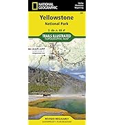
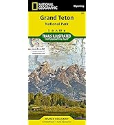
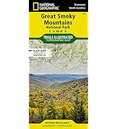
The rugged Wrangell-St. Elias Mountain Range straddles the border between the State of Alaska and the Canadian Yukon, with a front porch on the Gulf of Alaska. The Wrangell-St. Elias National Park is the largest by land area in the US, and is among the least traveled. National Geographic's "Wrangell-St. Elias National Park-Alaska" map provies topographic coverage of the park's terrain. One side shows the entirety of the park at a scale of 1:375,000. The other side has detailed inserts, at a scale of 1:85,000, of the most accessible areas, near the Gulf of Alaska port of Yakutat, near the old mining town of McCarthy and the Kennicot Mine off the Richardson Highway, and from the Nabesna access trail off the Tok Cutoff of the Glen Highway. The Wrangell-St. Elias National Park has very little supporting infrastructure and those who venture inside the park are advised to consult additional geodesy products to ensure sound navigation. The map itself is water resistant, flexible, easy to read, and easily transported in a pocket or rucksack. It is highly recommended as a plannng aid for those who have the opportunity to visit one of North America's great wild spaces.
Q**J
These are my go-to maps
These are great maps. Haven't covered all of the territory to comment further yet.
S**Y
I love the Nat Geo maps!
I'm going on a trip to Alaska this summer and wanted to have a good map of Wrangell-St. Elias for when I drive in on the McCarthy and Nabesna roads. I know I don't really need a map except what I could get at the ranger station, but I'm a map person and I get a lot more out of the trip if I can see where I am. I especially like that it has contour lines. It's small scale compared to standard 7.5 minute USGS topographic quadrangle maps, but I won't be backpacking so I don't need that level of detail. Plus, the map is waterproof and tear-resistant. Recommended.
Trustpilot
1 week ago
3 weeks ago