

Rocky Mountain National Park Map by National Geographic – Waterproof Hiking Trail Map (NG.NP.200) with GPS Compatibility for Estes Park, Trail Ridge & ... (National Geographic Trails Illustrated Map)
Product ID: 50241114
Desertcart purchases this item on your behalf and handles shipping, customs, and support to USA.
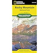
Discover Colorado's crown jewel with the National Geographic Trails Illustrated Map of Rocky Mountain National Park (NG.NP.200). Designed for outdoor enthusiasts, this GPS-compatible map offers the most comprehensive topographic detail for hiking, backcountry travel, and scenic exploration across one of America’s most visited national parks. From alpine lakes to wildlife corridors, plan your adventures confidently with clear trails, elevation contours, and visitor highlights across both east and west park sections. Key Features : Full Park Coverage : Includes Estes Park, Trail Ridge Road, Bear Lake, Longs Peak, Wild Basin, and Grand Lake. Topographic Detail : Clearly marked trails, campsites, ranger stations, backcountry zones, and elevation contours. GPS-Compatible : UTM and latitude/longitude grid for use with GPS devices. Waterproof & Tear-Resistant : Built for rugged conditions and repeated folding on the trail. Essential Park Info : Trail distances, visitor centers, scenic drives, and safety guidance included. The NG.NP.200 Rocky Mountain National Park Map is the trusted tool for navigating Colorado’s breathtaking mountain terrain. Review: Very good - Must to have if you are going to visit the Rockies! National Geographic's products are always the best! Buy it! Review: A Useful Guide - This is a very useful book if you plan to spend time in RMNP.








| Best Sellers Rank | 523,913 in Books ( See Top 100 in Books ) 1,476 in Geography References 3,685 in Adventure Travel (Books) 4,348 in Travel Atlases & Maps |
| Customer Reviews | 4.8 out of 5 stars 733 Reviews |
I**A
Very good
Must to have if you are going to visit the Rockies! National Geographic's products are always the best! Buy it!
L**O
A Useful Guide
This is a very useful book if you plan to spend time in RMNP.
C**N
Edición anterior a la anunciada
Se anuncia la revisión de 2012 pero llega la de 2008. De hecho las imágenes en la web no se corresponden con el producto recibido y en éstas el mapa corresponde a una edición con copyright de 2019
ザ**生
非常に見やすい
ロッキーマウンテン国立公園に行って、トレイルをいくつか回りまし。計画を立てるとき、実際にトレイルを歩くときにとても参考になりました。防水性もあり、使い易いことも利点です。
C**L
I love Trails Illustrated maps
I've always loved Trails Illustrated maps for their topographical lines, accuracy and good detail and this one is no different. Their maps stand out because they are foldable, but they have that coating that makes them more durable than regular paper maps and if they get water on them they're not ruined. There are a ton of trails in Rocky Mountain National Park and many of them dissect each other so it's important to have an accurate map that shows all the trail characteristics and scale of distances. Great map!
Trustpilot
3 weeks ago
4 days ago